

For Central Texas, the first weekend of October comes with a welcome change in temperature—and a reason to keep checking road conditions. The heavy-rain threat that dominated the end of last week was tied to a slow-moving front drawing on tropical moisture. The front has also opened the door to a cooler stretch, though an improving forecast is no reason to assume every creek crossing is clear.[3]
What happened late last week
On Thursday, October 1, Austin and Travis County activated their joint Emergency Operations Center at a limited level ahead of heavy rainfall. At the time, the National Weather Service Flood Watch for Travis County was scheduled to run through 7 p.m. Friday, October 2. The city relayed a forecast of 2–3 inches around Austin, with isolated pockets potentially receiving as much as 8 inches. Those were forecasts, not measured rainfall totals.[2]
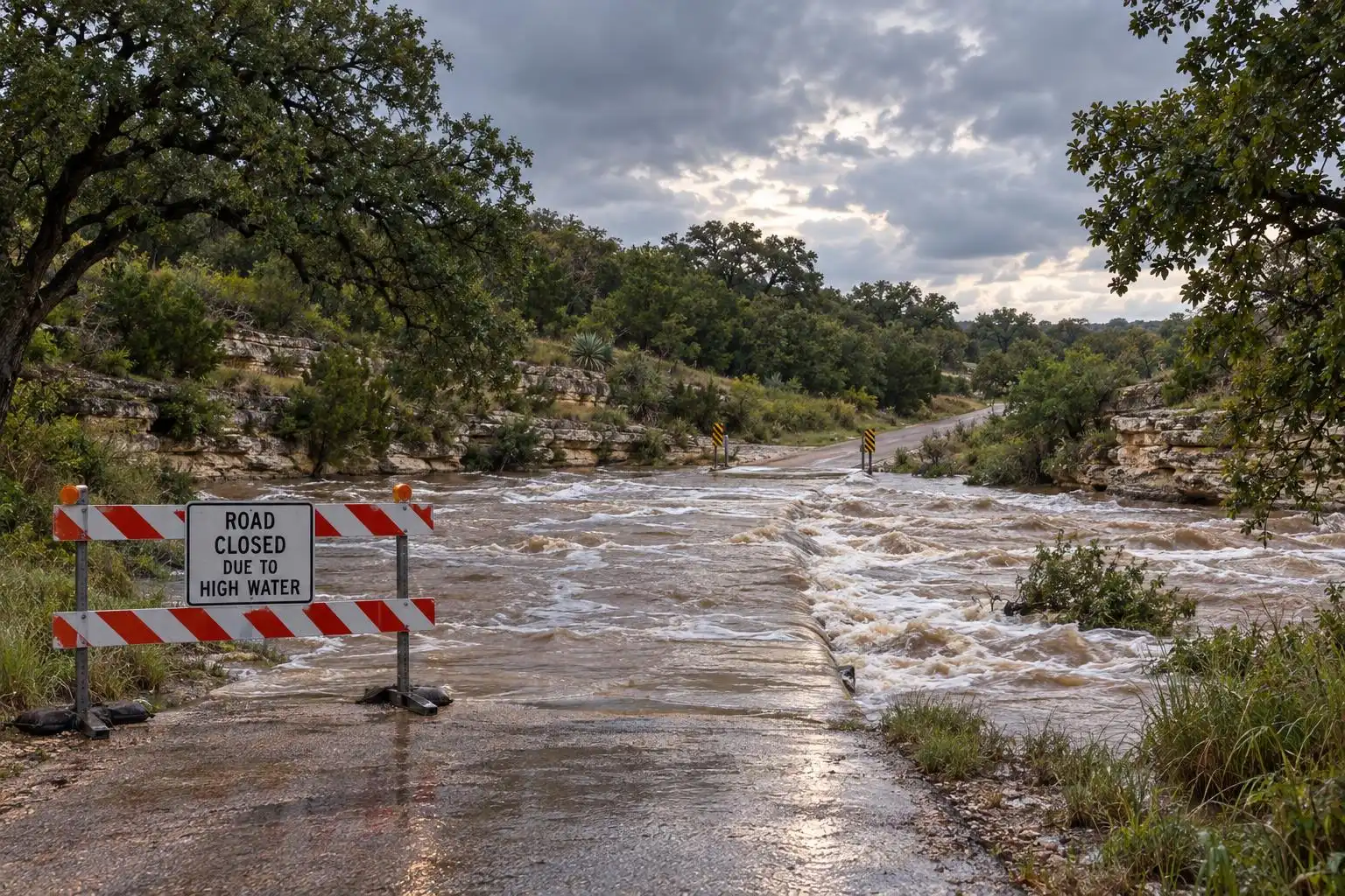
The danger was already taking shape west of Austin on Thursday morning. Flood alerts reported for Mason, Kerr and Gillespie counties included a Flash Flood Warning for Kerr and Gillespie. Those alerts had specific expiration times; they should not be read as warnings still in effect this Sunday.[7]
Why the rain became a flood concern
A front does more than replace one air mass with another. As it advances, it helps lift warm, moisture-laden air, which cools and condenses into rain. Last week, tropical moisture was already in place, while a low-pressure system and a slow-moving front helped sustain multiple rounds of storms. When downpours repeatedly pass over the same area, rainfall can accumulate much faster than roads and creeks can handle.[3]
That is why a regional rain forecast cannot tell you whether your route through the Hill Country is safe. Totals can differ sharply across short distances, and runoff can reach a low-water crossing after the heaviest rain has moved away. Before driving across Travis County or toward communities west of Austin, check current alerts and crossing conditions—not just the sky outside your window. Austin Watershed Protection directs residents to ATXfloods.com for low-water-crossing information.[2]
A cooler outlook for Austin
The supplied KXAN seven-day forecast shows Austin-area highs of 82°F Sunday, 83°F Monday, 84°F Tuesday and 86°F Wednesday, with forecast lows generally in the mid-to-upper 60s. That is a noticeable break from the near-100-degree heat forecast ahead of the front. It is also an Austin-area outlook, not a guarantee that Burnet, San Marcos, Round Rock or Waco will reach the same temperatures.[4][1]
A front can lower humidity as well as temperature by bringing in a different air mass. FOX 7 forecast a drop in humidity behind this system, but exactly how comfortable an afternoon feels will depend on when and how thoroughly the front clears your neighborhood. Treat those daily temperatures as a forecast snapshot and check an updated local forecast before making outdoor plans.[1]
What to do before heading out
This week’s practical takeaway is to separate forecast improvement from verified conditions on the ground. Last week’s Flood Watch was scheduled to end Friday evening, but its expiration alone does not establish the status of any later alert or flooded roadway. Check the latest National Weather Service alerts for your location, use the city’s crossing-status resource when traveling in Austin, and turn around rather than entering water over a road. Austin and Travis County also recommend enabling emergency alerts and registering with WarnCentralTexas.org.[2]
References
- Austin weather: Cold front to bring heavy rain, flood risks, and cooler weather — https://www.fox7austin.com/weather/austin-weather-cold-front-bring-heavy-rain-flood-risks-cooler-weather
- Austin-Travis County Emergency Operations Center Activates For Heavy Rainfall — https://www.austintexas.gov/emergency-management/news/austin-travis-county-emergency-operations-center-activates-anticipated
- Austin weather: Flood Watch issued as heavy rain, strong storms forecast — https://www.fox7austin.com/weather/austin-weather-flood-watch-issued-heavy-rain-strong-storms
- KXAN Weather Austin: Flood Watch ahead of heavy rain threat later this week — https://www.kxan.com/weather/forecast/heavy-rain-flood-risk-severe-threat-late-week
- Austin weather: Flood alerts issued in Central Texas as storms roll through — https://www.fox7austin.com/weather/austin-weather-flood-alerts-issued-central-texas-storms-roll-through


Leave a Reply