
Central Texas is living through one of the most meteorologically whiplash-inducing stretches in recent memory. Within the span of just a few weeks, the Hill Country has gone from catastrophic flooding to a building heat dome affecting Texas, with North Texas forecast to top 100°F by midweek. If you’ve been outside lately, you already know the air feels thick enough to chew — and it’s only going to get more intense before any relief arrives.
The Flood Damage: Kerr County Still Reeling
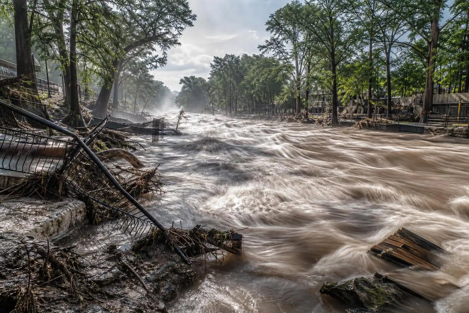
Before we look ahead at the heat, we have to acknowledge what just happened in our own backyard. The Texas Hill Country took a devastating punch from flooding last week, with Kerr County bearing the worst of it. According to reporting from KUT, nearly 500 homes and 100 businesses have been damaged in the latest round of flooding — and this comes less than a year after the catastrophic July 4, 2025 floods that killed more than 130 people along the Guadalupe River.[3] Two deaths have been reported across South and Central Texas in this most recent event.
The emotional and physical toll on Kerrville and surrounding communities is enormous. Residents who were just beginning to rebuild from last year’s disaster are now assessing damage all over again. Governor Greg Abbott has signed a major disaster declaration for the region, and the flood threat — particularly along rivers that are still rising — has not fully passed.[3]
On a brighter note for the Austin metro, Lake Travis is now full for the first time since 2019 following the heavy rain, according to Axios Austin.[5] Mansfield Dam’s floodgates were opened on Saturday for the first time in seven years to manage the surge of stormwater flowing down the Colorado River — a remarkable contrast to the drought conditions we’ve battled for much of the past several years.[3] Austin and Travis County also issued bans on lake and river activity during the peak of the flooding to protect residents from dangerous currents.
Now the Flip: A Heat Dome Builds Over the Region
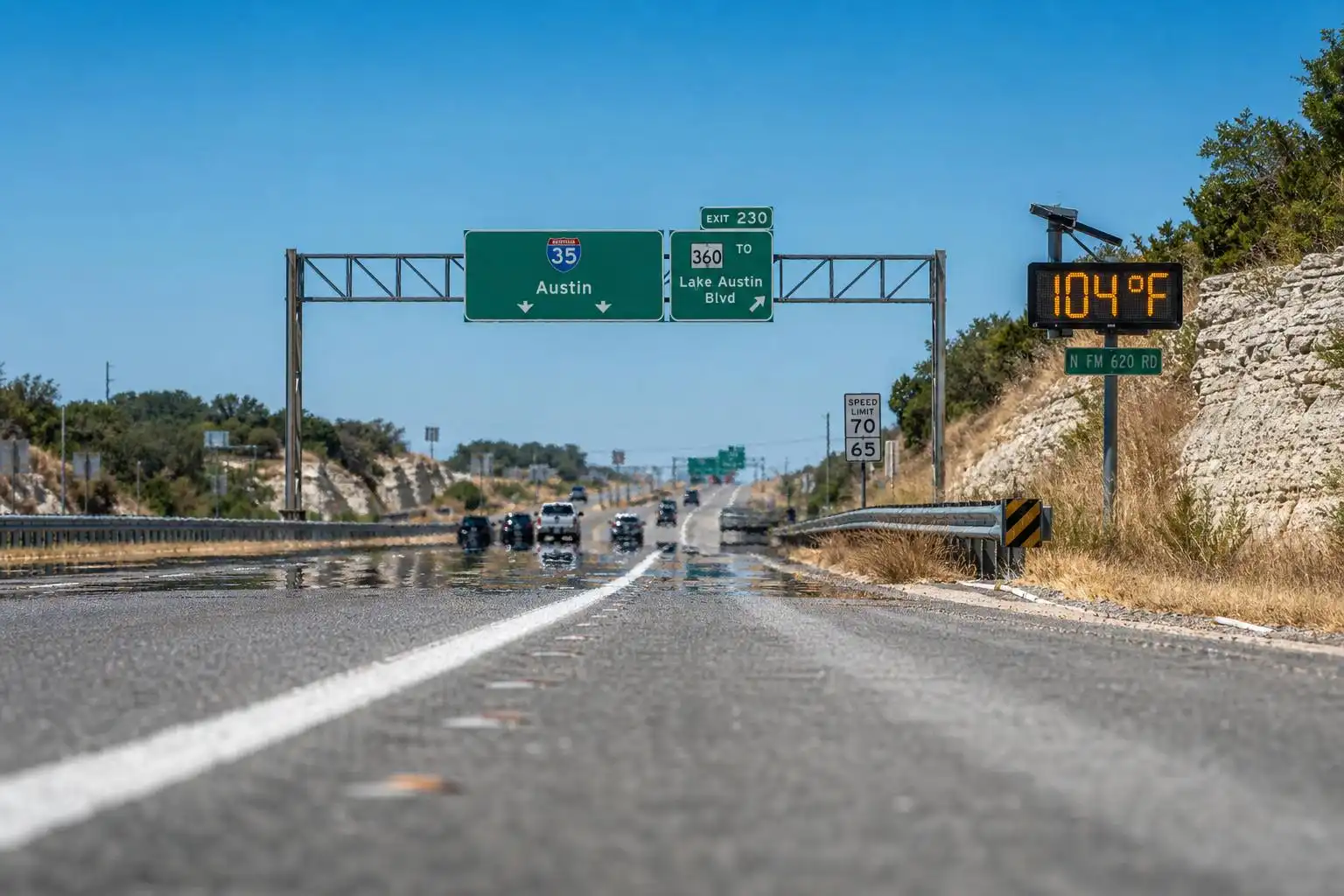
Here’s where things get uncomfortable in a very different way. After all that water, the atmosphere is now swinging hard in the opposite direction. A strong ridge of high pressure is building across North Texas this week, and CBS reports it’s going to squeeze temperatures above the century mark there by midweek.
To our north, the Dallas–Fort Worth area is already feeling the leading edge of this pattern. CBS forecast a Sunday high of 98°F by 5 p.m., with a breezy southerly wind pumping Gulf moisture northward and pushing heat index values into the triple digits.[1] That southerly flow is what’s delivering oppressive humidity to North Texas right now.
The forecast for North Texas calls for temperatures to climb above 100°F by midweek, with heat index values potentially ranging from 100 to 115°F — conditions likely to trigger heat alerts from the National Weather Service.[1] For Central Texas, the sources cited here do not provide the same city-specific highs, dew points, or heat-index values, so residents should follow local National Weather Service forecasts and alerts for Austin, San Marcos, Round Rock, Waco, and surrounding communities.
Why This Pattern Is So Relentless
Let me explain what’s driving this, because it’s worth understanding. The ridge of high pressure building over the region acts like a dome — it suppresses cloud formation, blocks storm systems from moving in, and forces air to sink and compress, which warms it further. CBS reported a breezy southerly wind component pulling moisture into North Texas, so rather than getting the dry heat you might expect from a classic Texas summer ridge, that area is getting the humid version — sticky, stifling, and far more dangerous to human health.
The dry streak ahead is also significant. After weeks of active storm patterns, CBS reports North Texas is now entering a period with little to no rain in the forecast.[1] In flood-affected areas, any extended hot, dry spell can begin drying soils rapidly under the heat, and drought conditions can reassert themselves faster than you might expect — especially in areas that didn’t receive the heaviest rainfall.
What This Means for You This Week
Here’s your actionable breakdown for the week ahead across the Austin, San Marcos, Round Rock, and Waco areas:
-
Monday–Tuesday: Monitor your local National Weather Service forecast for city-specific temperatures, heat index values, and any advisories. Stay hydrated and limit outdoor exertion to early morning hours.
-
Wednesday–Thursday: The ridge reaches its peak intensity in the North Texas forecast, where CBS expects highs above 100°F and heat index values of 100–115°F. This is the danger zone anywhere similar heat develops — heat-related illness risk is highest for outdoor workers, the elderly, young children, and pets. Heat alerts from the NWS are possible.
-
Friday–Weekend: Keep checking official local forecasts for any changes in heat alerts or storm chances. Don’t expect outdoor conditions to feel comfortable just because the worst of the flooding has passed.
Flood Recovery + Extreme Heat: A Dangerous Combination
One thing I want to flag that doesn’t get enough attention: the combination of post-flood cleanup and extreme heat is genuinely dangerous. Many Kerr County residents are right now hauling waterlogged furniture, tearing out drywall, and working outdoors in full sun — all while temperatures are surging.[3] If you or someone you know is doing flood recovery work in the Hill Country this week, please take the heat as seriously as you took the flood warnings. Schedule heavy work for before 10 a.m. and after 6 p.m., drink water constantly (not just when you’re thirsty), and have a cool, shaded rest area available.
Also worth noting: standing floodwater combined with intense heat creates ideal conditions for mosquito breeding and mold growth. Both become serious health concerns within days of a flood event. The Texas Department of State Health Services has resources available for flood-affected residents at no cost.
The Bigger Picture
Climate scientists have been warning for years that a warming atmosphere holds more moisture — and that when conditions align, that moisture gets released in more intense bursts.[3] What we’re seeing in Central Texas — catastrophic flooding followed almost immediately by dangerous heat — is consistent with that pattern. The Hill Country’s geography makes it uniquely vulnerable to “flash flood alley” events, and the same atmospheric dynamics that fuel those floods (deep Gulf moisture, unstable air) also set the stage for brutal heat when a ridge takes over.
This is not meant to be alarmist — it’s meant to be honest. Central Texas has always had extreme weather. But the extremes are becoming more extreme, and understanding why helps us prepare better.
Bottom Line for the Week
Stay cool, stay hydrated, and check on your neighbors. If you’re on or near any rivers or lakes in the Hill Country, continue to respect any active closures and watch for rising water — some rivers are still running high from last week’s rain. And if you’re doing any outdoor work or recreation this week, treat the heat index number — not just the air temperature — as your guide. A 102°F day with 70% humidity doesn’t just feel like 110°F; it stresses your body like 110°F.
We’ll be watching this pattern closely. If any storm systems threaten to break through the ridge later in the week, I’ll have an update here. Until then, find some shade, fill up your water bottle, and keep an eye on those around you.
References
- Mostly dry, hot Sunday for North Texas as temperatures climb this week — CBS News — https://www.cbsnews.com/texas/news/dry-hot-sunday-north-texas-dfw-weather-forecast-7-19-2026/
- Photos: Almost 500 homes and 100 businesses damaged in Kerr County floods — KUT — https://www.kut.org/energy-environment/2026-07-20/kerrville-flood-photos-texas-hill-country-kerr-county
- Weekender guide — Axios Austin — https://www.axios.com/local/austin/2026/07/24/weekender-guide


Leave a Reply