

If you stepped outside this past weekend and felt like the air itself was trying to cook you, you weren’t imagining it. Central Texas just endured one of the most punishing stretches of late-August heat in recent memory, and the week ahead offers precious little comfort. Buckle up — this is going to be a long one.
The Weekend That Was: Records Threatened at Camp Mabry
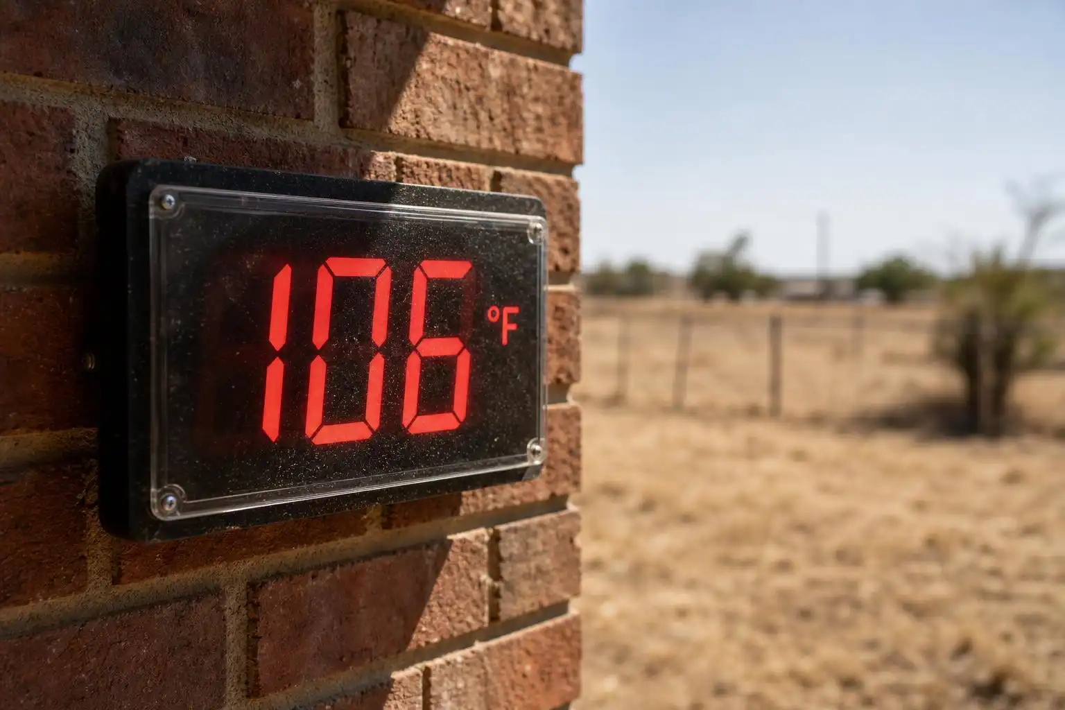
Let’s start with the numbers, because they’re genuinely staggering. On Sunday, August 23, Camp Mabry — the official climate station for Austin — was forecast to hit 106°F, matching the all-time record for that date set back in 2010. Across parts of South Central Texas, some locations pushed toward 107°F.[5] The National Weather Service issued an Extreme Heat Warning for Travis County through 7 p.m. Sunday, then immediately rolled it into a Heat Advisory that extended through 7 p.m. Wednesday — meaning Austin’s run of official heat alerts stretched unbroken into the middle of the week.[5]
NWS meteorologist Bob Fogarty put it plainly: “The real strong high pressure is sort of centered over West Texas, New Mexico, but it covers the whole state and it covers much of the southern central part of the country. It lets us warm up almost as much as we possibly can at any given day in the summer like this.”[5] That’s meteorologist-speak for: the heat dome is enormous, it’s stubborn, and it has no immediate plans to leave.
What You’re Looking At This Week
The 7-day forecast reads like a nightmare for anyone without a functioning air conditioner. After a slightly more “manageable” Saturday high of 93°F, the mercury climbs right back into triple-digit territory — Sunday at 100°F, Monday at 99°F, Tuesday at 100°F, Wednesday through Thursday at 101°F, and Friday topping out at a brutal 102°F.[1] Overnight lows, meanwhile, are barely dropping below 76–78°F by midweek — that’s dangerously warm, offering the human body almost no chance to recover from the daytime punishment.
The picture breaks down differently by region, and it matters where you live:
- Hill Country (Fredericksburg, Blanco, Llano, Burnet): Peak highs between 95°F and 99°F. Higher elevations will keep some communities just below the triple-digit threshold, though not by much.[2]
- I-35 Corridor (Round Rock, Austin, San Marcos): Sunny skies and urban heat island effects will push afternoon temperatures to 101°F or higher. The asphalt and concrete of the corridor trap and re-radiate heat, making these communities consistently the hottest in the region.[2]
- Coastal Plains (Bastrop, Smithville, Lockhart): Highs ranging from 100°F to 101°F east of I-35. The flat terrain and lower elevation offer no topographic relief.[2]
Earlier in the week, the window between Llano and Bastrop counties — including Austin proper — carried a greater than 70% model likelihood of exceeding 105°F, prompting the NWS to flag the area as having the “highest temperatures in South Central Texas.”[3] That’s not a forecast range you want to be on the wrong side of.
Wednesday’s Frontal Boundary: Don’t Get Too Excited
Here’s where things get marginally interesting from a meteorological standpoint — though I want to manage expectations carefully. A weak atmospheric disturbance in the form of a frontal boundary is expected to drift south from near the Red River on Wednesday, sending some clouds into Central Texas and possibly triggering a few isolated showers or thunderstorms late in the day.[4] Most of Wednesday will remain dry, with the subtropical ridge of high pressure still calling the shots.
Thursday, August 27 is the day forecasters are watching most closely. The NWS Austin/San Antonio office flagged a slight chance of rain — at or below 30% for most of the greater Austin–San Antonio corridor as of Tuesday — as that frontal boundary shifts further south and the atmospheric setup becomes slightly more favorable for convection.[3] By Wednesday, updated forecasts had raised that chance to around 40% for Thursday.[4] Any storms that do fire will likely be isolated and brief, offering localized relief rather than the widespread soaking the region desperately needs.
I’ll be honest with you: even a 40% rain chance in late August, under a dominant heat dome, is not the cavalry arriving. It’s a scout on a tired horse. Appreciate it if it shows up, but don’t count on it to break the drought.
The Humidity Factor: Feeling Hotter Than It Already Is
One detail that’s easy to overlook when you’re staring at a “mere” 100°F forecast: humidity is increasing as we move through the week. Saturday’s relatively lower humidity meant the heat index tracked only a degree or two above actual temperature — uncomfortable, but at least honest.[2] As moisture increases through the early part of the coming week, that gap between air temperature and “feels like” temperature will widen. On the worst days earlier this week, the heat index was approaching 115°F in some spots.[5] That’s the kind of number that turns a walk to the mailbox into a genuine health risk.
Looking Ahead: September Transition and El Niño Winter Dreams
September is traditionally Central Texas’s great pivot month. We typically open September with highs still in the 90s and lows in the low 70s, but by the end of the month, average highs can drop into the 80s and morning lows can dip into the 60s — the first real whispers of fall.[2] The Climate Prediction Center’s current outlook calls for a slightly warmer-than-normal September, though the month also carries the potential for near-average or above-average rainfall.[2] I’ll take it.
And if you need something to look forward to beyond that: the developing El Niño pattern is drawing attention from long-range forecasters. The Farmer’s Almanac and Old Farmer’s Almanac both favor a stormy winter across Texas, and the Climate Prediction Center is leaning toward wetter-than-normal conditions for the state through the winter months.[6] In strong El Niño years, a more active southern storm track can bring not just rain, but occasional sleet and freezing rain to Central Texas — and slightly elevated odds of snow in Austin and San Antonio.[6] It’s a long way off, but after a summer like this one, I think we’ve all earned the right to daydream about it.
Your Actionable Takeaways This Week
- Limit outdoor exposure between 11 a.m. and 6 p.m. The hourly data shows temperatures peaking at 100°F from roughly 4–5 p.m. and staying above 95°F well into the evening hours.[1] If you have to be outside, early morning — before 9 a.m., when temps are still in the upper 70s — is your safest window.
- Watch your pets. Austin vets are already warning that midday walks can be dangerous for dogs in this heat. Paw pads burn on pavement above 95°F, and heat stroke can set in fast.[5]
- Don’t skip hydration on “cooler” days. Saturday’s 93°F high may feel like a reprieve after last week, but it’s still 93°F. Heat-related illness doesn’t take a day off just because the number sounds smaller.
- Keep an eye on Thursday. That rain chance is real, even if it’s modest. If storms do develop, they could be locally heavy — and after weeks of drought, even an inch of rain in the right spot matters.
Stay cool out there, Central Texas. September is coming. Eventually.
References
- KXAN Austin Weather: Fall weather forecast released for Central Texas — https://www.kxan.com/weather/weather-blog/fall-weather-forecast-released-for-central-texas
- Austin weather: Will we get a break from 100-degree heat? — Austin American-Statesman — https://www.statesman.com/weather/article/austin-weather-weekend-forecast-hot-temperatures-22406702.php
- Central Texas rain chances inch up this week amid triple-digit heat — MySanAntonio.com — https://www.mysanantonio.com/news/weather/article/rain-san-antonio-austin-texas-22400730.php
- Austin weather: Heat hangs on in Austin but here’s a timeline for rain — Austin American-Statesman — https://www.statesman.com/weather/article/austin-forecast-extreme-heat-relief-rain-chances-22401842.php
- Austin could tie another record as extreme heat drags on — KUT Radio, Austin’s NPR Station — https://www.kut.org/energy-environment/2026-08-23/austin-tx-extreme-heat-warning-august-23-record-107
- Could Austin get snow this winter? What Farmer’s Almanac predicts — Austin American-Statesman — https://www.statesman.com/weather/article/austin-weather-winter-farmers-almanac-el-nino-22397068.php


Leave a Reply