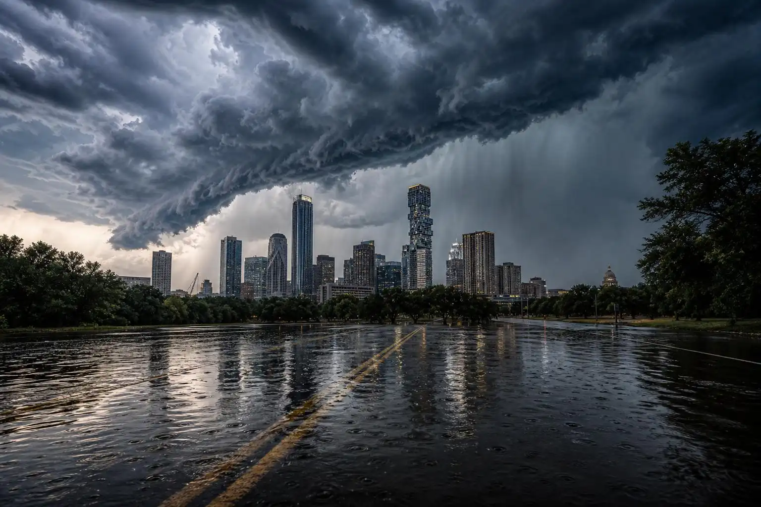

If you were hoping for a break from the brutal mid-July heat, well — you got one. Just not the gentle, pleasant kind. This week, Central Texas is caught in one of the more dramatic weather setups of the summer: a slow-moving atmospheric disturbance rotating around the southern edge of a high-pressure ridge — what meteorologists are calling a “ring of fire” pattern — is colliding with a deep reservoir of Gulf moisture to produce dangerous, life-threatening flooding across the region.
Let’s break down exactly what’s happening, where the greatest risks lie, and what you should be doing right now.
What Is the “Ring of Fire” Pattern?
This isn’t a volcanic event — it’s an atmospheric one. When a strong high-pressure dome sits over the southern United States in summer, weather systems can get trapped rotating around its edges. Thunderstorm complexes, impulses, and even organized vortices ride along this “ring,” repeatedly targeting the same geography with heavy rainfall.
This week, that bullseye is squarely on Central and South-Central Texas.
The National Weather Service described the mechanism plainly in their forecast discussion: “A mid-level impulse will rotate slowly around the south side of high and interact with the warm, moist air mass over South-Central Texas Tuesday night into Thursday morning.”[1] The result? Rainfall totals through Thursday could reach 2 to 6 inches across much of the area, with isolated spots potentially seeing up to 8 inches.[1]
And in the Hill Country, it’s even worse. Some areas west of San Antonio could see a staggering 10 to 20 inches of total rainfall by the time this system finally moves out.[6]
A Mesoscale Convective Vortex Is Driving the Worst of It
At the heart of this event is a Mesoscale Convective Vortex — or MCV — a rotating storm complex that has been producing torrential rainfall across the region for days. Think of it as a smaller, inland cousin of a tropical cyclone: organized, persistent, and capable of training intense rainfall over the same areas repeatedly.
The NWS has been watching this feature closely. “Wherever this MCV re-initiates will be where the heaviest bullseye of rain will fall,” NWS forecasters wrote, adding that “another 10 to 15 inches of rainfall will be possible in this heavier bullseye.”[5] Rainfall rates reaching 2 to 4 inches per hour have already been recorded, and with soils already saturated, even rates of 0.5 to 1 inch per hour are now sufficient to trigger flash flooding.[5]
By Tuesday afternoon, some areas had already picked up as much as 10 inches of rain, with the NWS warning of “life-threatening flooding” through Thursday.[2] The highest totals so far have been recorded in Uvalde County, where some spots have received up to 16 inches.[6]
The Hill Country Is at Maximum Risk — and the Trauma Is Fresh
For residents of the Texas Hill Country, this week’s event carries a weight beyond the meteorological. It was just one year ago that catastrophic flooding along the Guadalupe River killed more than 100 people, including dozens of children and counselors at Camp Mystic in Kerr County.[2]
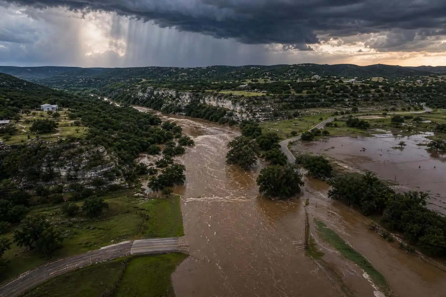
This week, flash flood warnings have again been posted for several counties near the Mexico border, including parts of Kerr County. Officials there have been in active contact with summer camps and retreat centers about the potential for river flooding.[6]
The NWS has issued a Level 4 of 4 — “High” — risk for life-threatening flooding, particularly along the U.S. 90 corridor west of San Antonio, where “considerable to locally catastrophic flash flooding is likely.”[5] Over 75 people have already been rescued from flood waters, and Governor Greg Abbott has issued a disaster declaration covering 59 Texas counties — more than 20% of all counties in the state.[2]
NWS senior branch forecaster Bob Oravec put it simply: “It’s a flash flood-prone area, so there’s most likely going to be some serious issues. You can’t always forecast exactly where the rain’s going to hit in the most flood-prone basins, but it’s definitely a big risk.”[2]
Why Does This Keep Happening?
This is not a once-in-a-generation event anymore — it’s a pattern that Central Texas residents need to understand and plan for. NWS meteorologist Monte Oaks explained the atmospheric setup clearly: “This is called a typical mid-summer tropical weather pattern that happens in Texas. About once every five years, we’ll get socked in with a daily recurrence of heavy rain chances that’s generally produced by a stagnant kind of a pattern with a low-pressure center that’s just not moving very fast.”[6]
The moisture fueling this event is primarily tropical — streaming in from the Gulf of Mexico, with some contribution from the Pacific.[6] A strong low-level jet overnight has been acting like a fire hose, pumping that moisture directly into the MCV’s circulation.[5] Once soils become saturated — as they now are across much of the affected region — the landscape loses its ability to absorb rainfall, and runoff becomes nearly instantaneous.
The Silver Lining: A Real Break From the Heat
For the Austin metro and surrounding communities, there is one genuine piece of good news buried in all of this: temperatures have dropped significantly. With abundant cloud cover and persistent rainfall, afternoon highs are running 5 to 10 degrees below the mid-July average of 96°F, with many areas staying below 90°F from Tuesday through Thursday.[1]
That’s a meaningful reprieve after weeks of triple-digit heat indexes. But don’t let the cooler temperatures lull you into complacency — this is not pleasant summer rain. This is a flood emergency.
What You Need to Do Right Now
Enable Wireless Emergency Alerts on your phone. Flash flooding can develop overnight while you’re asleep, and these location-based alerts can warn you about life-threatening conditions even when your phone is set to silent.[1] On an iPhone, go to Settings → Notifications → scroll to the bottom and make sure Emergency Alerts are toggled on.
Never drive through flooded roadways. “Turn around, don’t drown” is not a cliché — it’s the single most important action you can take. The majority of flood fatalities in Texas involve vehicles.
If you’re in the Hill Country or near any low-water crossing, monitor water levels constantly and have an evacuation plan ready. Rivers in this region can rise several feet in a matter of minutes.
Check in on neighbors and family, especially those in low-lying areas or near creeks and rivers.
Looking Ahead: When Does It End?
The most dangerous period runs through Thursday evening, when the Flood Watch is currently set to expire. After that, a gradual improvement is expected as the MCV weakens and the atmospheric pattern shifts. Temperatures will begin rebounding toward the end of the week, with sunshine returning and highs climbing back toward or above 90°F heading into the weekend.
But the ground will remain saturated well into next week, meaning even modest rainfall after the main event clears could still trigger localized flooding. Stay alert, stay weather-aware, and please — keep a close eye on those emergency alerts.
Stay safe out there, Central Texas.
References
- Forget the heat dome — the ‘ring of fire’ is taking aim at Texas – Austin American-Statesman — https://www.statesman.com/weather/article/austin-texas-forecast-rainfall-storm-timeline-22343006.php
- Texas Braces for Heavy Storms One Year After Deadly Floods – Insurance Journal — https://www.insurancejournal.com/news/southcentral/2026/07/15/877629.htm
- The Texas Hill Country Is Flooding Again — And It’s Bad – Forbes — https://www.forbes.com/sites/marshallshepherd/2026/07/16/the-texas-hill-country-is-flooding-again—and-its-bad/
- Heavy rains keep drenching South Texas after downpours led to dozens of rescues – Greenwich Time — https://www.greenwichtime.com/news/article/heavy-rains-keep-drenching-South-texas-after-22346097.php


Leave a Reply
You must be logged in to post a comment.